The Mississippi Sound to New Orleans
November 22, 2023
My last night a Cat Island wasn’t pleasant. The 100 km boat ride west to New Orleans, LA (NOLA) wasn’t swell either. The Mississippi Sound is the narrow 8-16 km wide waterbody between the mainland and a string of barrier islands known as the Gulf Islands. These were created about 4,000 years ago by an older version of the Mississippi River delta. The Sound has an east-west fetch (its length) that includes AL, MS, and LA. It is typically <15’ (4.5 m) deep and most often <10’ deep with a sand/silt bottom. It is great shrimp habitat and therefore a place with lots of shrimping boats or ‘shrimpers’. The best place for a boat is on the Gulf Inter-Coastal Waterway (GICW). It is the dredged canal 10-15’ deep, 500 m wide, mostly straight, just not in one line because it weaves among the numerous shoals, and as per my usual these days, it is full of towboats and their barges. My approach to NOLA also resulted in following seas (a tail wind from the east) producing waves to 1 m, wind gust to 25 knots, overcast skies and intermittent rain, fog that limited visibility to 100 m, and a stream of towboats and shrimpers. I spent those 4 hours with my hands tight on the wheel as I negotiated the channel using the navigation chart, scanning the fog for buoy markers, preparing to pass towboats, and weaving my way amongst the shrimpers where the waters were deep.
A side note about when to travel by boat. Boaters develop a ‘go-no-go’ weather and waves criteria to decide when to transit waterbodies. WW’s ‘go-no-go’ is 12-2-2, which is ≤12 knots of wind, ≤2’ waves (0.75 m), and a wave period, or frequency in seconds, >2x the wave height in feet. These are the guidelines I use for a comfortable ride, and these will be different for other boats and captains. Sometimes you can gamble and go outside of these conditions, but it is highly likely it will be a bumpy ride. Of course, a forecasted thunderstorm is a ‘no-go’, no discussion. You invest significant time and effort every day on weather forecasts, updates, and local conditions from the boating forums online. Life on the water is an amazing experience full of fun and adventure, but it is a very challenging job that includes this weather watching all day, every day.
On this day I was outside my go-no-go guidelines, but a very big tropical storm was brewing for the week which forced me to move for shelter and I gambled on NOLA. Approaching NOLA from the east you pass through a large lagoon named Lake Borgne. It was a lake in the 1700’s, but the Mississippi River and hurricanes opened it to the sea to create the present-day lagoon – check out an original map in the gallery. I could either head north through the ‘The Rigolets’ channel then west through Lake Pontchartrain or continue west along the GICW towards the city and the Mississippi River. Lake Pontchartrain is not a lake either, it is an estuary to the Gulf of Mexico connected by a deep-water channel and thus, the ‘lake’ is a mix of salty and fresh waters. The wind and waves were increasing on the lake, so I stuck to the GICW.
The fog lifted as I followed the towboats into the ‘Rigolet Cut’, the 150 m wide and 4 m deep canal. The canal is designed for single file towboating which translates to a deeper boating lane that is <100 m wide with shallows filled with emergent wood debris, a.k.a. logs from storms past and constant towboat disturbance. I was glad for the improved visibility because the canal was also a popular fishing area with small boats uninterested in moving for me. If I don’t slow to <7 knots, then my wake creates a bouncy situation for small boats close by. Despite slowing down and because there was no room in the canal to get clear of the fishers, I was getting a few angry captain stares. I suspect they moved for the towboats.
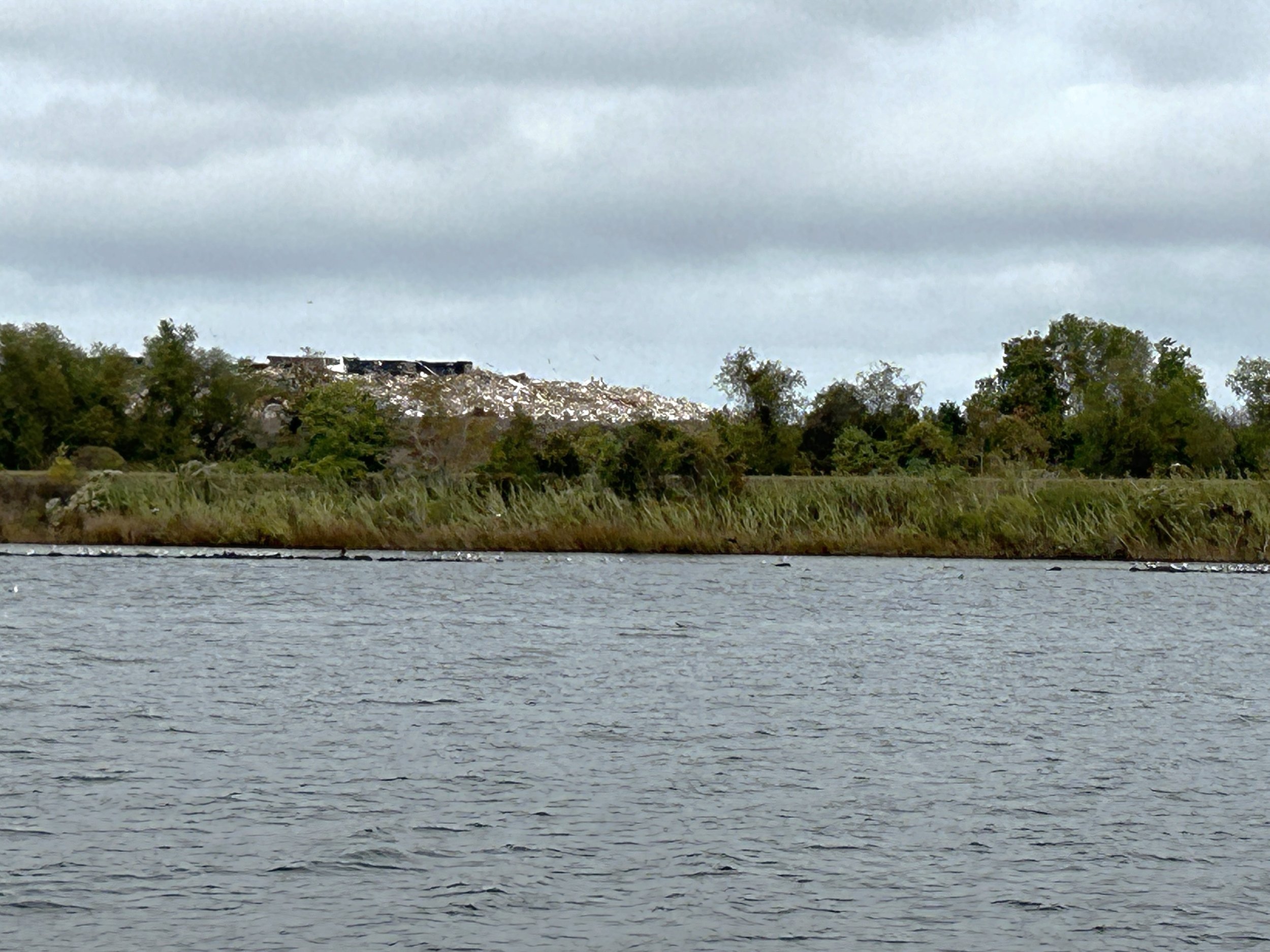
In addition to the boating fun, my ride into the city was quite interesting. I saw the Chef Menteur Pass, a natural, deep channel connecting Lake Pontchartrain to Lake Borgne. ‘Chef Mentuer’ may have been the local Indigenous peoples’ name for the lying French governor of the 1700s. I passed through the massive gates of the Lake Borgne Surge Barrier built because Hurricane Katrina pushed Gulf water up the Mississippi River–Gulf Outlet Canal which contributed significantly to the flooding that destroyed 10,000+ homes in the city. I saw the active Gentilly Landfill where a stream of trucks dumped garbage along the side of the waterway. This landfill was closed by the city in the 1980s because of water contamination but reopened to take the refuse and wreckage of Hurricane Katrina along with another poorly planned site down the road at Chef Mentuer. You can read a very interesting summary of managing the hurricane debris here. My last leg was a short run up the Inner Harbor Navigation Canal toward Lake Pontchartrain to my dock at the New Orleans RV Resort and Marina. It is nestled within the heavily industrialized canal shores next to the local community of Gentilly Woods built to service this industry in the 1950s, and built about 2 m below the canal water level behind a levee wall like most of the city.
NOLA was turning out to be full of stories about water and people to be continued in the next chapter.
Poking along the Gulf Coast,
Allen
Gulfport, MS


